- Súgó Pension
- Programmes
- Nearby attractions
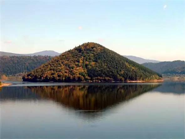
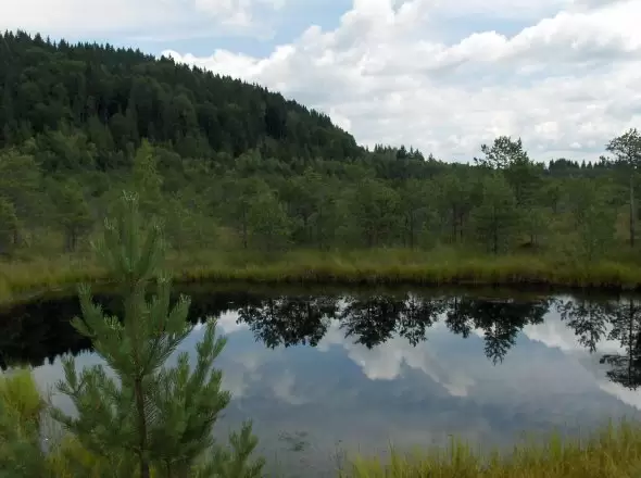
The Zetelaki reservoir is an artificial lake near Zeteváralja, which was created for the purpose of flood protection and river regulation. Its construction began in 1976 and was completed in 1992. During construction approx. 3 million cubic meters of earth were moved and more than 70,000 cubic meters of concrete were used. Its function is, on the one hand, protective: it protects the settlements in the valley from receding floods, and on the other hand, it ensures the adequate water flow of Nagy-Küküllő during a long period without rain.
The reservoir is a popular destination for anglers, as countless species of fish live in the water: bream, trout, bream, crucian carp, carp, perch, pike, walleye, bream, tench, perch...
The length of the road from Súgó Panzió: 22.3 km, approx. 41 minutes.

Szejkefürdő is part of the settlement of Székelyudvarhely, 4 km north-west of the city in the hollow valley of the Sós-patak. In 1850, there was a wicker swimming pool in the settlement, which was bought by Balázs Orbán in 1871. The writer from Székelyföld modernized the pool, built thermal baths, restaurants, and a hotel. On the beach, you can taste petroleum-based wine water suitable for a drinking cure, take a hot sulfur bath, or try the mofetta (steamer) and healing mud. It is also worth visiting the wine museum. Wine water springs erupt in several places on the estate.
During his lifetime, Balázs Orbán (Lengyelfalva, February 3, 1829 – Budapest, April 19, 1890) visited Székelyland. He visited every settlement, castle ruin, and natural rarity, and then wrote a six-volume book from his travels entitled "Description of Székelyföld from a historical, archaeological, natural history and folkloristic point of view". The writer was buried in Szejkefürdő after his death. The tomb of the writer of Székelyföld, decorated with seven Székely gates, was inaugurated in 1932 in the settlement.
The length of the road from Súgó Panzió: 37.7 km, approx. 58 minutes.

The history of the church and monastery in Csíksomlyó dates back to the 15th century. At that time, the Franciscan monks settled here, and between 1442 and 1448 they built the first Gothic church and the also Gothic small monastery. János Hunyadi also contributed to the construction of the church from the spoils obtained from his victory over the Turks. The church was consecrated in honor of Our Lady of Sarlós, and this is still the church's farewell day. Only a portal and a cellar window remain from this first monastery. The church and monastery were surrounded by a strong stone wall, to which the people of the area fled during enemy invasions in the following centuries.
The length of the road from Súgó Panzió: 79 km, 1 hour 30 minutes
Farkaslaka is located 13 km from Székelyudvarhely, north-west, on both banks of the stream called Nyikó, in the western forecourt of Gordon's roof. The name of the settlement may come from the fact that, according to tradition, many wolves lived in the surrounding forests, which sometimes ventured into the village and attacked the freely grazing horses.
While visiting Farkaslaka, it is worth seeing the Roman Catholic church built in 1842 in classicist style, the wooden statue of Mary on the side of Gordon Hill, the Jesus Heart lookout, and the grave of the settlement's most famous native, Áron Kossuth Prize-winning Hungarian writer.
Áron Tamási died on May 26, 1966 in Budapest. At his request, he was buried in his native village. His grave is in the churchyard. His tombstone was created by Transylvanian sculptors Jenő Servátiusz and Tibor Servátiusz.
The length of the road from Súgó Panzió: 46.7 km, approx. 1 hour 6 minutes.

The town is located 26 km west of Székelyudvarhely, at the confluence of the Gagy and Fehér-Nyikó rivers into the Nagy-Küküllő. Here you can see the statue of Sándor Petőfi, which the Székelykeresztúrváros erected in January 1973 for the poet, who spent his last evening in the settlement, in the Gyárfás mansion.
The length of the road from Súgó Panzió: 64.5 km, approx. 1 hour 24 minutes.

Lázár Castle is one of the most beautiful creations of 17th-century Transylvanian architecture, a listed Renaissance building. Its predecessor was the András manor house built in the 15th century, which was rebuilt several times. The largest renovation was carried out in the 17th century, when the castle was transformed into a Renaissance style. In the courtyard along the high walls stood the former farm buildings: kitchen, oven, servants' quarters, military quarters, well, blacksmith's workshop, stables. Creative camps have been organized in the castle since 1974. The building was renovated in 1980, and a museum was installed in its bastions. The Szárhegy Cultural and Art Center, a sub-institution of the Hargita County Council, currently operates in the castle.
The length of the road from Súgó Panzió: 65 km, approx. 1 hour 24 minutes.
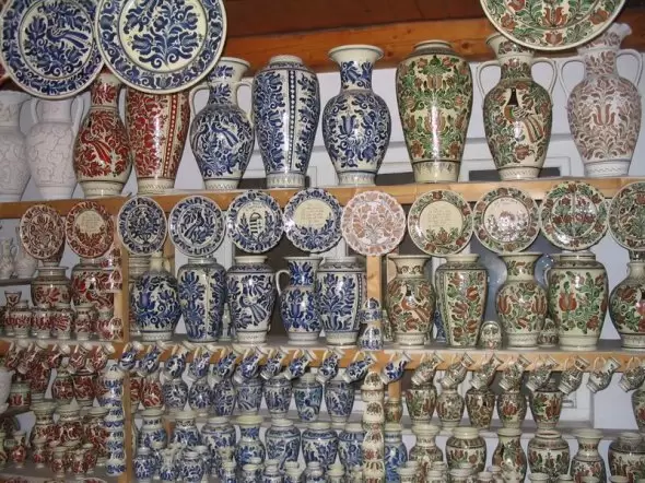
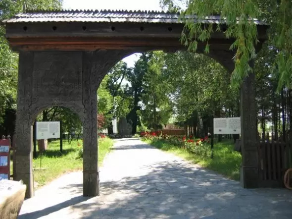
The village is located 26 km north-west of Székelyudvarhely. Korond is the most famous settlement of the Salt Region. In the Middle Ages, the locals made a living from selling salt in addition to agriculture. However, after the Székely Uprising of 1526, their right to free use of salt ceased, so they looked for a new profession and started working in pottery. In 1820, 50 and in 1893, 367 potters worked in the village. Their products were initially sold in nearby settlements, later beyond the Carpathians. Korond is still a famous pottery village. In addition, the people of Korond are true masters of tactile processing. Caps, hats and ornaments are made from it. You can admire and buy Korund handicrafts at the permanent unloading fair next to the main road.
Walking through the settlement, you can see many beautiful wooden Székely gates. It is worth visiting the old Roman Catholic and Unitarian churches, as well as visiting the village museum.
The length of the road from Súgó Panzió: 63.4 km, approx. 1 hour 19 minutes.

Nyerges-tető is an 878-meter-high pass in Harghita County, Romania, connecting the Háromszéki Basin and the Csíki Basin between the Csíki Mountains and the Torjai Mountains. It is interesting that the pass was the scene of countless bloody battles during the Tatar and Turkish incursions. It is best known as one of the last scenes of the 1848-49 revolution and freedom struggle in Székelyföld.
On the site of the battle, a memorial column was inaugurated in 1897 in memory of the fallen heroes, which was made by master stonemason János Poulini from Csíkzsögöd. Opposite the monument, on the edge of the forest, the victims of the battle are buried in a mass grave. Their graves are guarded by numerous small and large wooden and iron crosses and headstones.
The length of the road from Súgó Panzió: 71.4 km, approx. 1 hour 25 minutes.

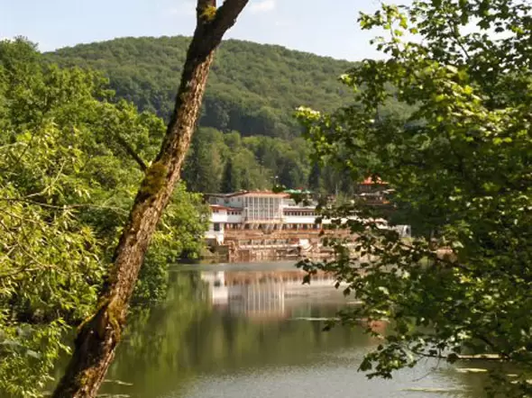
Parajd is one of the most important salt mining centers in the Carpathian Basin. Its name comes from the noun paraj: while the salt transporters loaded their carts with salt, they grazed their horses in the settlement. At the time, this activity was called "steaming".
Salt mining here can be traced back to Roman times. However, the first written record only dates back to 1405. Parajd is famous for the medical treatments carried out in the salt mine, which were started in the 1960s. The treatment department was arranged 120 meters below the surface. During the season, 2,500-3,000 patients visit here daily. A church and a playground were built 120 meters deep in the mine.
If you visit Parajd, it is worth seeing Sószoros, which was formed in the southwestern part of Só-hegy, and Sósfürdő, which is an open-air beach. Its pools are filled with water pumped out of the salt mine, so bathers can get to know the feeling of floating here, since it is almost impossible to submerge in the water - just like in the Dead Sea.
The length of the road from Súgó Panzió: 72.3 km, approx. 1 hour 29 minutes.
The largest heliothermic lake in the world, Medve-tó, is located north-west of Parajd. It lies in a beautiful, picturesque environment, in a sinkhole surrounded by forests, five hundred meters above sea level. Its water heats up to 35 degrees Celsius to a depth of 2 meters, but at the time of its formation, temperatures of 80 degrees Celsius were measured in its hottest layers. Its salinity is 100 g/l on the surface, 220-300 g/l deeper. Its shape resembles a spread bear skin - hence its name. Due to the special composition of its water, it is suitable for curing many diseases. Due to its high salt content, bathers actually float on the surface of the water.
The length of the road from Súgó Panzió: 82.7 km, approx. 1 hour 43 minutes.

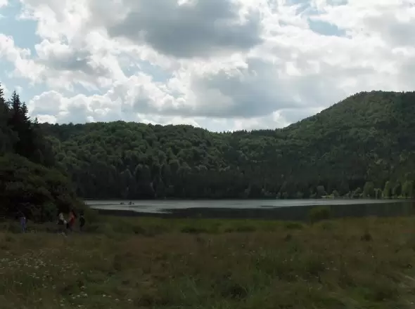
Lake Gyilkos is located at an altitude of 983 meters, and its maximum depth is 11 meters. The picturesque lake was created in the summer of 1837 as a result of debris sliding down from a nearby mountain. The remains of the pine forest still stand out from the water. There is a legend about its origin: according to folk tradition, it got its name from the fact that flocks and shepherds met their deaths under the suddenly subsiding debris.
The length of the road from Súgó Panzió: 86.3 km, approx. 1 hour 48 minutes.

Gyimesbükk is one of the easternmost settlements of historical Transylvania. Here the Tatros River and the railway line leave Transylvania and cross into Moldavia. The guardhouse was built in 1897 on the basis of a contract between the Hungarian and Romanian states, as part of the Csíkszereda-Gyimesbükk-Palánka-Kománfalva railway line. Guardhouse No. 30 was renovated for Whitsun 2008 with an international collaboration, and an exhibition of railway history can be seen in it.
The sights of Gyimesbükki include the former Rákóczi castle, the ruins of which can be found on the right side of the Gyimesi gorge, the old Roman Catholic church (Kontumáci chapel), the new church, and the Gyimes csángó landscape house created by ethnographer Mária Antalné Tankó.
The length of the road from Súgó Panzió: 86.7 km, approx. 1 hour 42 minutes.

The 5-kilometer Békás Gorge is part of the Nagyhağlams National Park. The area was declared protected in 1971. The gorge is connected by Kis-Cohárd (1344 m), Csíki-bükk (1264 m), Oltár-kő (1154 m) and Mária-kő (1125 m), which are nearly vertical limestone rocks. The gorge with its 200-300 meter high rock walls is one of Europe's natural rarities and a paradise for climbers.
The Hóvirág cave is the only known larger cave in the gorge, which was discovered in 1937. Its room is 28 meters long and 26 meters wide.
In Békás-szoros, you can see many protected plants: habitats of mountain gorse, lilac, lady's petal and yew. Its fauna is also diverse: ravens, lynxes, brown bears, weasels, wolves, and the Apollo butterfly also live in the area.
The length of the road from Súgó Panzió: 89.8 km, approx. 1 hour 49 minutes.
The Moss peat bog fills the northern, 800-meter-diameter crater of the twin craters of the Csomád Mountains. (Szent Anna Lake is located in the other crater). The thickness of the peat is ten meters, and its volume is about 3 million cubic meters. This special natural rarity was formed when the water of the former Mohos lake disappeared, leaving behind only a bog overgrown with dense vegetation, mainly peat moss. The bog is a protected natural asset, part of the Moss Nature Reserve.
During our excursion, we can admire many remnant plants from the Ice Age: for example, carnivorous plants, round-leaved dew grass, more than 20 types of moss grass, cranberry, peat rosemary, and headwort. The fauna of the peat bog is also interesting: a total of 108 species of spiders live here.
The peat bog can be accessed on the same road as Lake Szent Anna. We leave the car in the parking lot. It is important to know that the protected peat bog can only be visited in groups, requiring a guide.
The length of the road from Súgó Panzió: 94.7 km, approx. 1 hour 55 minutes.
Lake Szent Anna was formed on the southernmost block of the volcanic range of the Hargita Mountains, in one of the two twin craters of the Csomád Mountains. (The other crater is filled by the Moss peat bog.) This special natural formation was created in the only intact volcanic crater in Central-Eastern Europe. Its water surface is 949-950 meters above sea level. Its shape resembles a painter's palette. Its circumference is 1,617 meters, and its maximum depth fluctuates around 6-6.3 m. The interesting thing about the lake is that since its water is fed only by precipitation falling on the surface and water seeping in from the crater rim, it contains less dissolved minerals than distilled water, and because of this it freezes more easily. In the winter, a very thick layer of ice forms on it, on which you can walk up to the middle of the lake.
The length of the road from Súgó Panzió: 99.1 km, approx. 2 hours and 2 minutes.
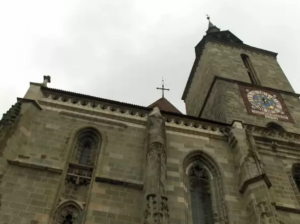
The Black Church in Brasov is the largest church in Romania. On April 21, 1689, a huge fire destroyed the city, in which the church was destroyed. It was then christened the Black Church. The soot was removed during the modern renovation.
The church was built between 1383 and 1477 on the site of the St. Catherine's Church, Újbrassó Parish Church, which was destroyed during the Tatar invasion, and which was the center of the deanery from 1295. In an interesting way, it not only survived the ordeal of the fire, but was also damaged in an earthquake in 1738. It was rebuilt by masters from Danzig between 1762 and 1772. Later, after World War I, they began to renovate it, and the work was only completed in 1999.
The length of the road from Súgó Panzió: 120 km, approx. 2 hours 29 minutes.

The castle was built in 1377 with the permission of King Louis I of Hungary. At that time, the important trade route passing by was controlled from the fortress, and it was also defended against the incursions of the Romanian voivodes of Havasföld. It is interesting that it has only one entrance: a thick-walled gate tower, which was originally led to by a movable wooden staircase. This was replaced by a stone staircase during the renovations. The castle is located 100 meters high on the mountain, its ground plan is trapezoidal. His basement used to be a prison. The 70-meter-deep well used by the residents can still be seen in its yard.
The castle has recently been restored: it has been completely renewed, so it is now in excellent condition. It functions as a museum, with a permanent exhibition of memorabilia from the Romanian royal family. It is also interesting that the legends consider the castle to be one of the castles of Vlad Tepes, who entered the public consciousness as Count Dracula.
The length of the road from Súgó Panzió: 141 kilometers, approx. 2 hours 47 minutes.